Project Overview
Full Project Title
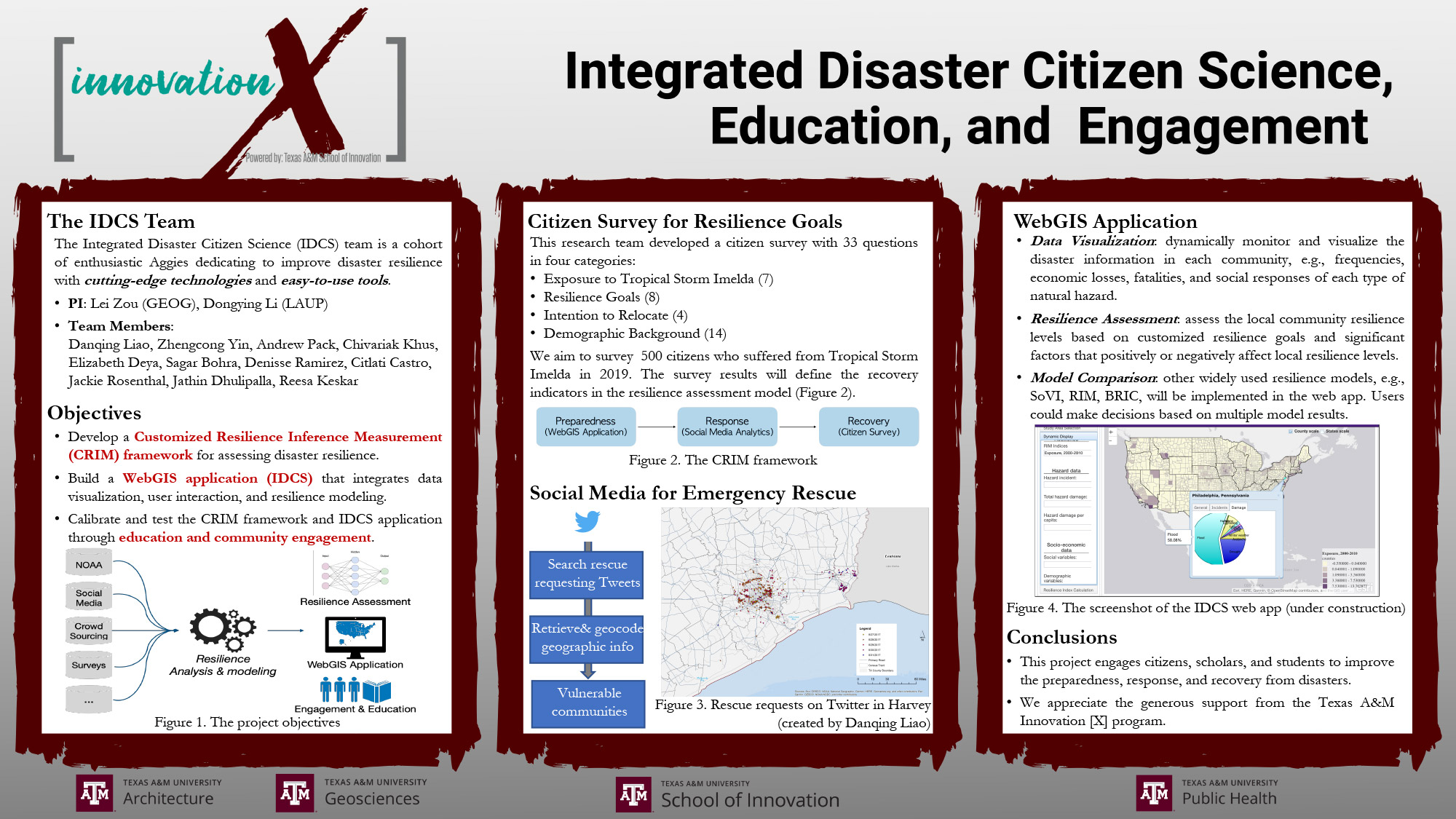
Integrated Disaster Citizen Science, Education and Engagement: A Customized Resilience Inference Measurement (CRIM) Framework
Background
Disaster resilience is the capacity of a community to prepare for, absorb, recover from and adapt to disastrous events. A variety of resilience measurement models have been proposed, but most aim at developing standardized metrics. Although standardization can facilitate comparison and uniform disaster recovery policy, it hinders the development of place-based solutions that address the challenges and resilience goals of specific communities. As an operationalized concept, both the anticipated resilience goals and process to achieve the goals rely heavily on local contexts, including the size of the community, demographics, affluence and deprivation, as well as the underlying economic and social structures. The dynamics in environmental and human systems also demand the goals to be ever-adaptive. Therefore, externally imposed and static resilience frameworks often fall short in stimulating local changes in disaster preparedness and recovery. To fill these gaps, this project aims to develop and evaluate an innovative resilience framework based WebGIS that for participatory goal setting, real-time volunteered geographic information, data computation and analysis, and feedback loops.
Projected Goals
The main goal of this project is to develop a customized resilience measurement framework through WebGIS-enabled community engagement, service learning and citizen science. The Manchester/Harrisburg neighborhood in Houston has been selected as the test bed, because of high minority population, poverty, complex socio-economic issues, and severe losses during Hurricane Harvey. The specific objectives are:
1. Develop a WebGIS application that integrates data visualization, user interaction and resilience modeling. The app fulfills three missions:
First, it monitors and visualizes local disaster-related information dynamically. The app integrates official environmental, plan-related, and socio-economic information, and mines social media (e.g., Twitter) to analyze disaster assistance request and recovery-related sentiments. Second, the platform supports user determined resilience goals by prompting for importance ratings of key recovery metrics and local design suggestions. Based on the input, an online module will compute community disaster resilience and identify key local social-environmental factors based on the CRIM framework (Obj.3). Third, the outcomes of the model are displayed, with additional functionalities to retrieve and compare multiple previously specified models.
2. Conduct community meetings through an interdisciplinary service-learning studio class to calibrate the CRIM framework.
We will develop a service-learning GeoDesign studio (LAND602/URPN 493) to increase students’ exposure to resilience modeling and community engagement. Through Texas Targeted Communities (TTC), we will build connections with Manchester neighborhood and hold community meetings. Students will assist participants from different interest groups to develop their resilience goals and generate output. Using the model results and key social-environmental factors identified, the class will develop specific goal-oriented design scenarios and action plans with the public.
3. Complete the Customized Resilience Inference Measurement (CRIM) framework for assessing community disaster resilience.
The CRIM framework will be completed based on PI Zou’s previously published Resilience Inference Measurement model combined with the customized resilience goals acquired through public engagement (Obj.2). The model assesses disaster resilience based on the exposure to hazards, damage sustained, and post-disaster recovery. Local resilience levels are estimated using k-means clustering of the customized indicators for three dimensions. Social-environmental factors contributing to or impeding disaster resilience will be assessed using Bayesian networks.
4. Test the applicability of framework by crowdsourcing.
The platform will be open to the public in the U.S. Data Display and computing capabilities will be expanded. User input and model results will be used to evaluate the applicability and limits of the framework beyond the initial test community.
Projected Outcomes
Four major outcomes are anticipated:
1. Publications: We expect to publish the CRIM framework and its applications in high impact journals such as Global Environmental Change and Annals of the American Association of Geographers.
2. Web Application: The WebGIS platform developed will be open to the public, facilitating work of disaster planners, researchers, community advisory groups and every resident.
3. Vertical Integration in Education: The vertical GeoDesign studio at the 4th undergraduate and 2nd graduate levels will involve students from LAND, URPN, GEOG and PHLT. Students will participate in webGIS mapping, model specification, resilience driven community planning and design, and become fully involved in community engagement.
4. Social Impacts: Fourth, we will strengthen our partnerships with Houston communities through Texas Targeted Communities, and produce white papers on the planning and design outcomes
Results
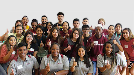
Meet The Team
Team Leaders
- Dr. Lei Zou, Visiting Assistant Professor (appointed Assistant Professor, effective Aug. 2019), Department of Geography, College of Geosciences; lzou@tamu.edu; (979) 458-1803(979) 458-1803
- Dr. Dongying Li, Assistant Professor, Department of Landscape Architecture and Urban Planning, College of Architecture
Graduate Student Team Members
- Sagar Bohra, Management Information Systems, Mays Business School
- Jathin Dhulipalla, Management Information Systems, Mays Business School
- Chivariak Khus, Health Promotion and Community Health Sciences, School of Public Health
- Danging Liao, Urban Planning, College of Architecture
- Andrew Pack, MD Plus Program, College of Medicine; Health Promotion and Community Health Sciences, School of Public Health
- Zhengcong Yin, Geography, College of Geosciences
Undergraduate Student Team Members
- Citlali Castro, Sociology, College of Liberal Arts
- Elizabeth Deya, Public Health, College of Public Health
- Reesa Keskar, Applied Mathematical Sciences, College of Science
- Katherine Stoeckl, Philosophy, College of Liberal Arts (Fall 2019)
- Jaclyn Rosenthal, Management Information Systems and Business Honors, Mays Business Schools
Units Represented
- Department of Geography
- College of Geosciences
- Department of Landscape Architecture and Urban Planning
- College of Architecture
- Urban Planning
- Public Health